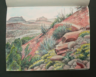
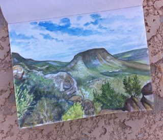
Reflections on the creek running down Woods Canyon, Sedona - another page from my Arizona travel sketchbook.
Thursday, December 31, 2015
Reflections On Woods Canyon
Reflections on the creek running down Woods Canyon, Sedona - another page from my Arizona travel sketchbook.
Monday, December 28, 2015
Friday, December 25, 2015
Red Rock Beach
A travel sketch of boulders and sky reflections at Red Rock Beach. This is in the lower section of Sedona's Woods Canyon Trail.
Thursday, December 24, 2015
Wednesday, December 23, 2015
Walk Around Airport Loop
Another page from the Arizona travel sketchbook - the walk around Airport Loop in the center of Sedona.
Sunday, December 20, 2015
On The Way to Chicken Point
The view on the way to Chicken Point.
The palette, a simple piece of aluminum foil used with Sakura Koi watercolors tubes.
Monday, December 14, 2015
On Submarine Rock
In this foreshortened view of Submarine Rock, looking toward west Sedona and Coffee Pot Rock, that pinky-orange color known as "Sedona Red" got lost. Tough to capture, camera and watercolors tend to go too far in either direction, between red and yellow. As for the foreshortening itself, to get a sense of scale, imagine the greenery on the rock to be the height of an average human.
Labels:
Arizona,
hiking red rock,
Nancy Boudreau,
Sedona,
Submarine Rock,
travel sketches
Sunday, December 13, 2015
Saturday, December 12, 2015
Broken Arrow Trail
The Broken Arrow Trail is heavily traveled and parallels a jeep road out to Submarine Rock and Chicken Point. The popularity of this route is deserved, given the continuous scenic views interspersed with intimate passages through the forest. This is the second Sedona scene from my Arizona travel sketchbook.
Friday, December 11, 2015
Bell Rock Loop at Sunset
After four days of hiking, scenes from Sedona are beginning to make their appearance in my Arizona travel sketchbook. In this view at sunset, the foot traffic around Bell Rock and Courthouse Butte have been chased away as blue shadows pool across the flats and begin to flood the high ground.
Tuesday, December 8, 2015
North from the Fortress
A watercolor sketch of the view looking north from the highest point on Elephant Mountain Trail, Spur Cross Ranch Conservation Area, Cave Creek, Arizona.
Elephant Mountain North
Climbing the trail up the north side of Elephant Mountain, the trunk being the peak in the upper right corner, this is yet another page out of the travel sketchbook.
Desert foothill hiking on overcast days is very comfortable, but the real treat is when sun breaks through the clouds* sending patches of light that scan across Earth's contours, as if an almighty being were seeking something with its celestial flashlight.
*"Sun Through Clouds" piano instrumental by Matthew Morgan - thank you for the inspiration.
Monday, December 7, 2015
Sketch of Solar Oasis
A sketch of the Solar Oasis at Spur Cross Ranch Conservation Area, where both humans and wildlife find relief from the sun, dust, and heat.
Sunday, December 6, 2015
Travel Sketch from Sidewinder Trail
This is another sketch from my AZ travels - a view from one of the higher elevations on Sidewinder Trail in the Sonoran Desert Preserve.
Saturday, December 5, 2015
Desert Broomrape
This travel sketch is from a February 2014 hike in the Spur Cross Ranch where Cooper's broomrape was found peeking out of the rocks along the trail. The four variations of Desert broomrape are all leafless, parasitic plants that live on the roots of native flora and are sometimes known by the more descriptive name of "burroweed strangler".
Friday, December 4, 2015
Elephant Mountain from Tortuga Trail
Today's offering is a sketch of the view of Elephant Mountain from Tortuga Trail in the Spur Cross Ranch Conservation Area. The Aravaipa Running club has two long distance events scheduled for these trails on February 20th.
Thursday, December 3, 2015
Wilted Datura
Wednesday, December 2, 2015
Traveling Sketches from Arizona
Thanksgiving in Arizona, spending time with family and hiking in the foothills carrying camera, sketchbook, pencil, and watercolors. The first page of the book is a view of Spur Cross Road, traveling north into the foothills, where conservation groups and land trusts have managed to preserve some of the best hiking trails in the Phoenix area.
Subscribe to:
Comments (Atom)


